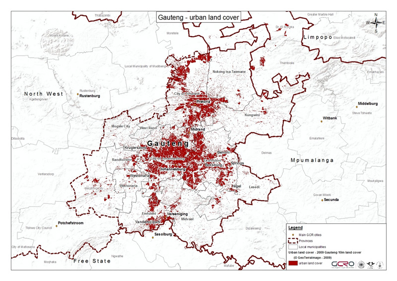
The urban landscape of Gauteng is reflected in the map below with land cover in 2009 derived from satellite imagery. The urban population is mainly located in a central north-south spine, in the large metros of Johannesburg, Tshwane and Ekurhuleni.
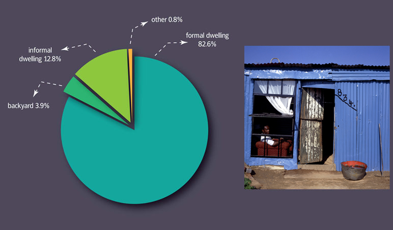
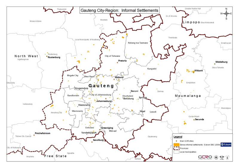
The majority of Gauteng residents (72%) live in houses or formal structures on a separate stand, but a large percentage (12.8%) live in informal settlements. These informal settlements are depicted below and are spread out across the city-region. The Gauteng Provincial Government faces huge challenges providing housing and services for these ever-expanding informal settlements, because the massive population growth in the GCR ensures that this is a moving target. |