| future change | ||
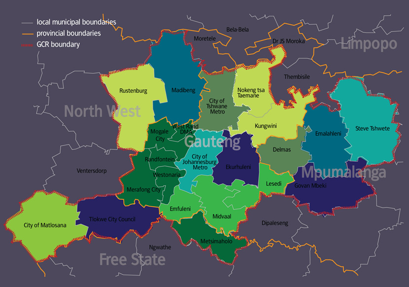
The map below shows the local government structures in Gauteng, as well as municipalities making up the broader GCR. It is important to note that these arrangements are not static. For example, at the moment district municipalities manage services directly in some parts of their jurisdiction, usually protected areas or areas the where population is very sparse. These are so-called District Management Areas (DMAs), where there are no local (that is, lower-tier, Category B) municipalities. There is currently one DMA in Gauteng, under the West Rand District. However, DMAs are in the process of being phased out, and so this area which covers the UNESCO World Heritage Site of the Cradle of Humankind will formally become part of Mogale City. In addition, the Independent Demarcation Board has taken a decision to merge a portion of the Metsweding District Municipality area into Ekurhuleni, and the rest into Tshwane. This means the entire area in the north-eastern part of Gauteng will be covered by single-tier metropolitan government after the next local government elections in early 2011. |
||
| the GCR: Gauteng and adjacent local municipalities | ||
 |
||